

SityTrail for all of your outdoor activities anywhere in the world
SityTrail World is a GPS for all of your outdoor activities anywhere in the world.
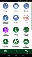
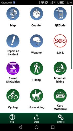
Here are its main functions:
★ WORLD MAPS IN YOUR POCKET
All the maps you need to discover the world on foot, cycling, horse riding, or by car, motorbike or quad bike. Comprehensive and highly accurate coverage of the Blue Planet.
Subscription charge: The application can be accessed for free for a week’s trial. You may then take out a subscription for €19.99 per year, all-inclusive.
★ MAPS AND YOUR WALKS AVAILABLE IN OFFLINE MODE
The download tool lets you get the most out of your maps and routes on the ground without any internet connection.
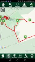
There is an alarm when you stray from the route being followed. No more need to continuously check your smartphone, this alarm system will stop you getting lost or having to turn back on yourself.
Automatic activation of points of interest and text to speech synthesis.
An elevation profile that enables the visualisation of inclines and of any difficulties along the route.
★ RECORD YOUR ROUTES WITH PHOTOS
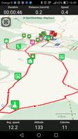
Record your walks in real time on the ground, and create points of interest with your own photos and commentary.
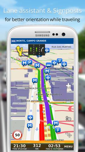
Display showing distance covered, time taken, average speed, GPS altitude, inclines (+/-), and many other useful indicators for walkers and mountain bikers.
Estimate of distance and time remaining based on your average speed.
Elevation profile for the current recording.
★ CREATE AND SHARE YOUR WALKS
With our online editor, create your own walking projects using an internet navigator on your PC/MAC and then accessing them directly from your mobile to experience them on the ground.
Go further. Transform your favourite walks into real multimedia guides with text, photos, video links, and share them with the SityTrail community.
Access too to thousands of walking circuits from other members and let yourself be guided!
★ TOURIST ATTRACTIONS AND WEATHER SERVICE
Get plenty of localised tourist information: articles Wikipédia, accommodation, restaurants, and various services such as chemists and banks.
Save your favourite places so you can consult them during your trip.
Check on the five-day weather forecast for any location on the map to help you organise your stay.
★ ADDITIONAL FUNCTIONS
Easily create points of interest, such as the location of your car, your hotel, or a restaurant.
In the event of any problems, the SOS function enables you to send your GPS coordinates to your contacts.
Geocachers can use the compass to find their way to a geocache.
★ ANDROID WEAR SMARTWATCH
- Route and GPS position visualisation.
- Indication of distance covered and remaining.
- Arrow display indicating the direction to be taken.
- Alarm when you stray from the route.
We hope you enjoy discovering the world with SityTrail.
Application Manual: http://www.sitytrail.com/lang-en/manuals_trail.html
For any questions or suggestions: http://www.sitytrail.com/lang-en/support_trail.html
- - -
Some functions need an internet connection.
The prolonged use of GPS can reduce battery levels.
Free world maps by © OpenStreetMap contributors








 Download