
Type in your route, click a button, then receive your VFR nav calcs via the web
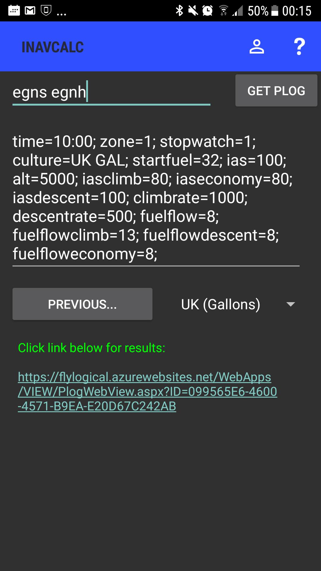
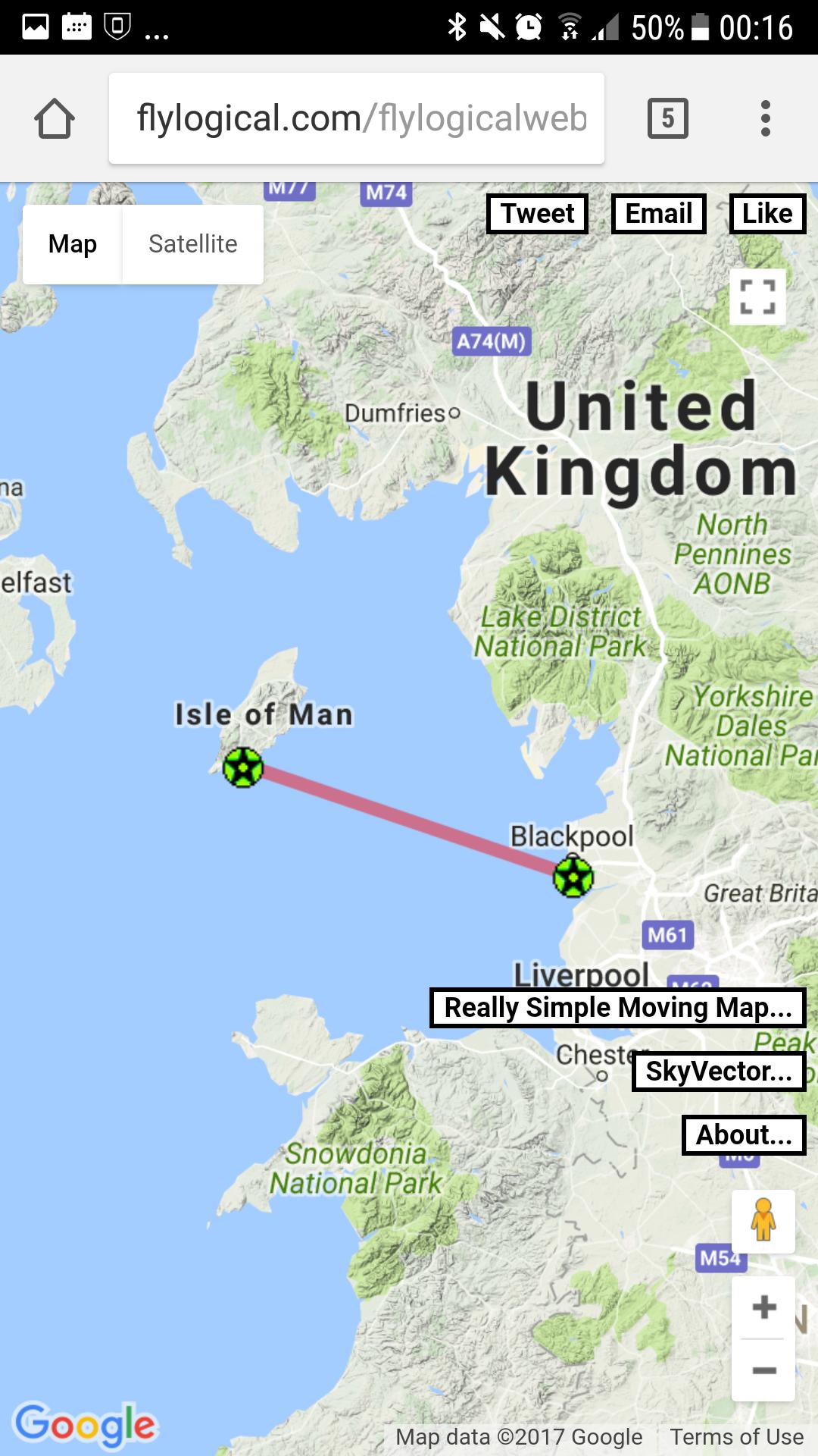
This app assists pilots in their VFR pre-flight navigation planning:* Create your route by simply typing the list of desired waypoints * Single click to generate your Pilot's LOG (PLOG) comprising all your navigation calculations for your route. Your PLOG, MET (METARS, TAFs), NOTAMS, and NAVCOM FREQUENCIES reports are made available via a file download page. The URL for this page can be shared (via email, social media, etc.)* PLOG features:-- drift uses the current MET to determine winds aloft for each waypoint along the route-- magnetic heading uses a numerical geomagnetic model to calculate the magnetic deviation -- altimetry (transition levels, flight levels, etc) and performance (density altitudes, freezing altitude, etc) calculations along the route-- solar angle calculations (azimuth and zenith) along the route -- includes fuel consumption profile along the route (including consideration of fuel consumption for initial climb-out, and any en route changes in altitude)-- includes range and endurance estimation for possible diversion* Specify wide range of parameters for the PLOG calculations including altitude profile along the route, airspeed profile along the route, date and time of departure (including UTC offset for local time), waypoint at which the stopwatch is zeroed (e.g., to enable PLOG times to be computed relative to a specified starting waypoint which can be different from the departure airfield).* Save parameters & preferences for convenience and later re-use (requires free registration)* Creates ".gpx" ".fpl" format files for easy import into other software tools and devices* View route in GoogleMaps, SkyVector, and FlyLogical's ReallySimpleMovingMap web appThis update is a complete rewrite of the app. It has been streamlined compared with earlier versions, and no longer requires registration with a FlyLogical user account (though registration is still supported and enables additional functionality such as accessing waypoints etc saved in the Cloud). Download